Andradas - Pico do Gaviao
State of São Paulo, Brazil
Inicia sesión para obtener el último tiempo!
Es gratis unirse a spedmo y comenzar a colaborar
Condiciones actuales
No hay alertas.
Recuerde antes de cada vuelo, revise su equipo , reevalúe las condiciones y pregúntese si estoy seguro .


Dirección de viento de lanzamiento requerida

Fabinho mostrando o controle do parapente Enzo no vento forte no pico do gaviao em Andradas. Faz parecer fácil.
Aaron Hughes Agregó esto
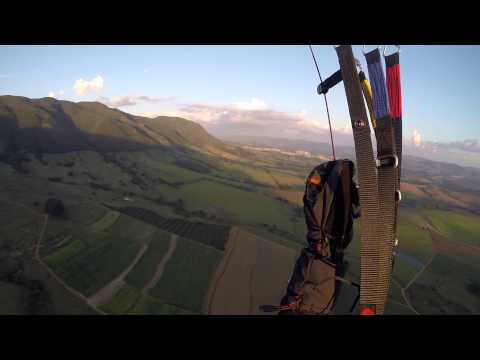
Quick sunset flight down from Pico do Gavião (Andradas MG, Brazil)
Aaron Hughes Agregó esto

Vôo de Parapente com os pilotos Raul Guedes, Kido, Daniel Homsi e Tatá Homsi em Andradas, Minas Gerais, Brasil.
Aaron Hughes Agregó esto

Quitarse
-22.0156, -46.6265 : 1634.0 m
Zona de aterrizaje
-22.0454, -46.6259 : 942.0 m
amanecer
5:21 a. m.
Puesta de sol
6:19 p. m.
Zona horaria
hora estándar de Brasilia (-0300)
One of the top-5 Brazilian sites, where remarkable XC flight records were registered.
10 different concrete and natural ramps for take-offs on a huge well-cared field, allowing for simultaneous take-offs. Many options heading South. Heading North, on a farm below. 168 miles from São Paulo. Take the road to Poços de Caldas and drive until Andradas; there, take the first or the second exit on the left after the Antenna Hill. Follow the signs to the ramp, which is on the border of São Paulo-Minas Gerais states.
Wide and strong thermals make the flight non-advisable for rookies at noon time. Meteo: http://www.picodogaviao.es...
Las siguientes personas están siguiendo activamente las actualizaciones de este sitio.


